|
Sundial
Museo della Civiltà Contadina del Friuli
Imperiale (Sundials courtyard)
Photo n° 3 |
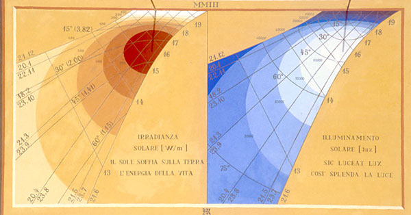
Calculations were made
using the “SUNSPEC” model of the “Florida Solar Energy Center”.
The quadrant on the left also shows the local solar time,
diurnal lines, the height of the sun above the horizon (the
number in the brackets indicates the optical air mass, that is
the measure of the trajectory across the atmosphere taken by the
rays of the sun, in respect to the length of the trajectory
along the vertical line).
The right hand side quadrant also
shows the local solar time, diurnal lines, and the sunbeams
incidence angle in respect to the line perpendicular to the
surface.
|